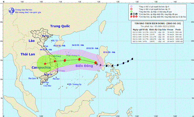
Storm Goni poses danger both on mainland and at sea
Goni, the 10th storm to enter the East Sea this year, is dangerous both on the mainland and at sea, with vessels operating in the affected zones bearing high risks from gusts, said Director of the National Centre for Hydro-Meteorological Forecasting Mai Van Khiem.
-
 Vietnam’s fertility plummets, workforce quality concerns mount: national survey
- Vietnam seeks stronger cooperation with EU, Belgium in environment, sustainable development
- Mekong Delta emerging as plastic waste “hotspot”, experts warn
- Building a synchronous transport system to create momentum for economic development
- Government allocates 140 billion VND to support flood-hit provinces
- New laws on innovation, corporate income tax enacted from October 1
- Vietnam eyes 140,000-strong workforce to power high-speed rail network
- Ministry calls for drastic solutions to reduce air pollution
- Proactively respond to natural disasters
- Accelerating the embankment project in Kien Tuong Ward


