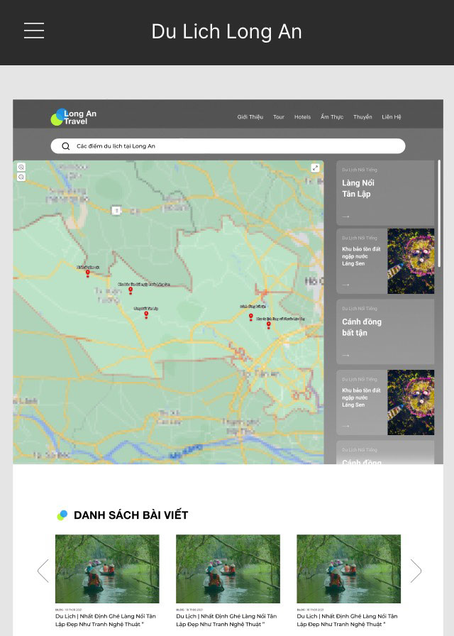
Basic outline of digital map interface (Photo provided by TPIC)
Creating convenience for visitors
When the epidemic becomes a global concern, the province's tourism sector determines that the trend of self-travelling or backpacking will be the type of choice for many tourists in the future. In this form, visitors can actively build a schedule suitable for their own time, interests and characteristics and at the same time limit the concentration of people during travel.
In order to catch up with the trend and prepare carefully for the "return day" of Long An tourism, the provincial tourism center plans and conducts the construction of a digital map. This will be a lively, effective and easy information channel for those who are interested in Long An tourism based on the form of setting up a coordinate system to guide tourist attractions in the whole province.
The digital map will act as an open website, providing visitors with necessary information about weather, directions, descriptions of destinations, places to eat, accommodation, etc. Tourists make their own travel itineraries. It operates in the form of an open website, digital maps are provided to travel agencies, local tourism businesses, tour guides and especially tourists having the right to supplement and modifying some information related to business units and individuals (under the control of the page administrator), thereby it increases interactivity, helps the information to be updated timely and continuously.
Besides the utility that provides specific information about the destination such as preferential policies, promotions, etc., tourists can access the digital map to look up the safety level of the destination. According to information from TPIC, the digital map will overcome some limitations in using GoogleMap to look up the way. Because it is built by the method of placing landmarks to locate all destinations capable of tourism or as a basis for searching, the digital map will allow more specific identification of location, boundaries, and scale of each location searched. The open feature helps to increase the interaction between visitors, travel agencies and accommodation. Then, visitors' questions about the weather and the way will be answered promptly and quickly.
Working hard to complete the plan
As expected, by the end of December 2021, the digital map will be put into trial operation with at least 50 percent of tourist destinations and facilities put up. Director of the Provincial TPIC - Do Thi Kim Dung said that the center would also build a collaborative force in order to make the implementation faster, more detailed and more effective, the center would also build staff who are responsible for setting landmarks and collabobrators from districts, town and city. With the advantage of being a local, knowledgeable about the land and people where they live, the collaborators will provide accurate, complete and reliable information for the digital map.
In addition to the force to collect information from reality, there is also a staff to synthesize, update information, put digital maps on the internet platform, monitor, grasp, edit and supplement necessary information, control the additional content. Currently, the basic design is completed, the marking of landmarks is specifically assigned to each officer, official and collaborator and will be conducted individually as soon as possible. Specialist of the Professional Division, TPIC - Nguyen Vo Dang Duy said, currently, the basic interface of the digital map website has been sketched. The planting of landmarks will take place soon when the social distancing order is eased. Anh Duy and his co-workers are trying to complete the digital map according to the plan.
When the basic digital map is completed, new information and events of the province will continue to be updated regularly, accurately and attractively to increase the level of interaction and attract the attention of visitors, contributing to promote the image of Long An tourism. So far, Long An is the first province in the Southern region to have the idea of implementing digital maps for tourism./.
By Que Lam – Translated by Duc Tam
Source: https://baolongan.vn/phat-trien-du-lich-long-an-tren-nen-tang-so-a120435.html
 Vietnam sees record foreign tourist arrivals despite stormy season


