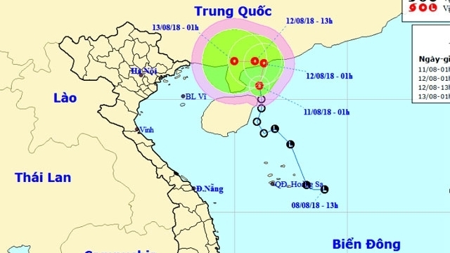
Tropical depression causes heavy showers and thunderstorms
As of 1am on August 11, the centre of a tropical depression entered the northeast of China’s Hainan Island, with the strongest wind near its eye at approx. 40-50kph, according to the latest information from the National Centre for Hydro-Meteorological Forecasting (NCHMF).
-
 ASEAN, China strengthen joint efforts to combat cross-border cybercrime
- Consolidating and promoting the strength of national solidarity
- First kidney transplants from brain-dead donor performed in Mekong Delta
- HCM City to break ground on 1.8-billion-USD Metro Line 2 in early 2026
- Vietnam to pilot online tax declaration portal this month ahead of 2026 rollout
- For a plastic-waste-free environment
- Vietnam to develop a world-class Olympic sports urban area
- Removing site clearance 'bottleneck' to speed up key projects
- Vietnam’s drive to extinguish smoking by expanding smoke-free areas
- Environmental protection—from awareness to action


