Vietnamese | English

05/06/2018 - 18:02

Tropical depression strengthens to tropical storm

A tropical depression currently active near the Hoang Sa (Paracel) Archipelago has strengthened into a tropical storm, becoming the second such storm to affect Vietnam this year, the national weather service has announced.

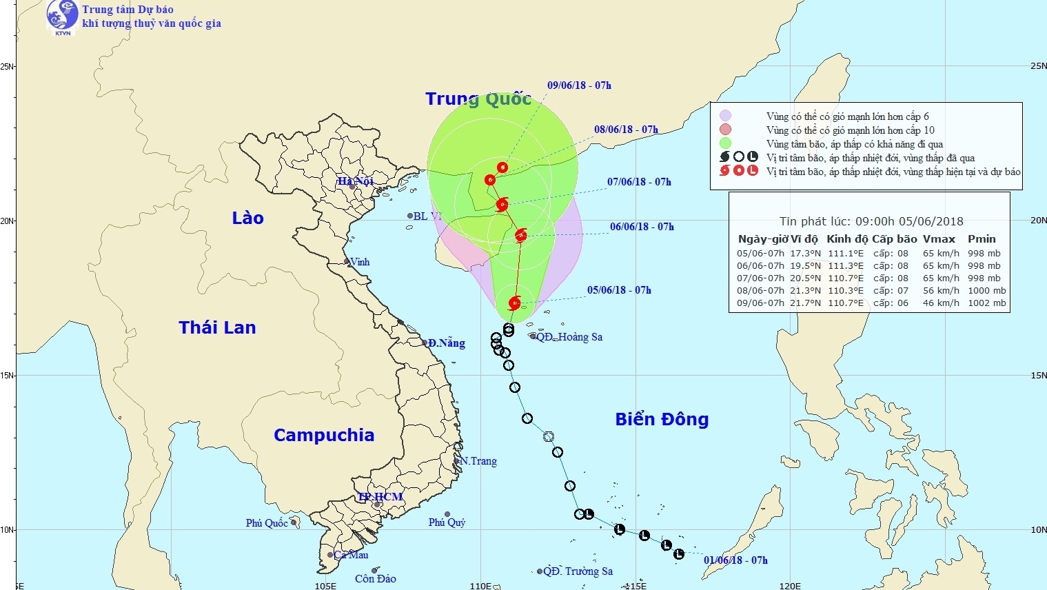
The projected path of the tropical storm

As of 7h00 on June 5, the storm is located at latitude 17.3 N, longitude 111.1 E, to the northwest of the Hoang Sa Islands and about 190 kilometres to the southwest of China’s Hainan Island.

Winds near the eye of the storm are sustained at 75 kilometres per hour, with gusts as high as 100 kilometres per hour.

The tropical storm is forecast to move northwards over the next 24 hours at a speed of 5-10 kilometres per hour, causing very rough seas in the northwestern area of the East Sea (including the Hoang Sa archipelago).

It will also bring heavy showers, thunderstorms, tornadoes and strong gusts off the coast of Vietnam’s central region and the Gulf of Tonkin.

The storm is expected to reach the area to the east of the Leizhou Peninsula on June 7 before weakening into a tropical depression and abating further.

Earlier, on June 4, the General Department for Natural Disaster Prevention asked the General Department for Fisheries to work closely with the Border Guard Command to support fishing vessels in the affected zones to steer their boats to safety.

Meanwhile, a number of provinces have also imposed a ban on fishing boats from going to sea./.

NDO

Share